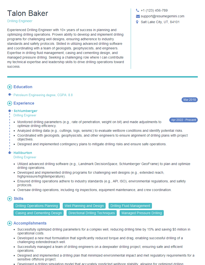
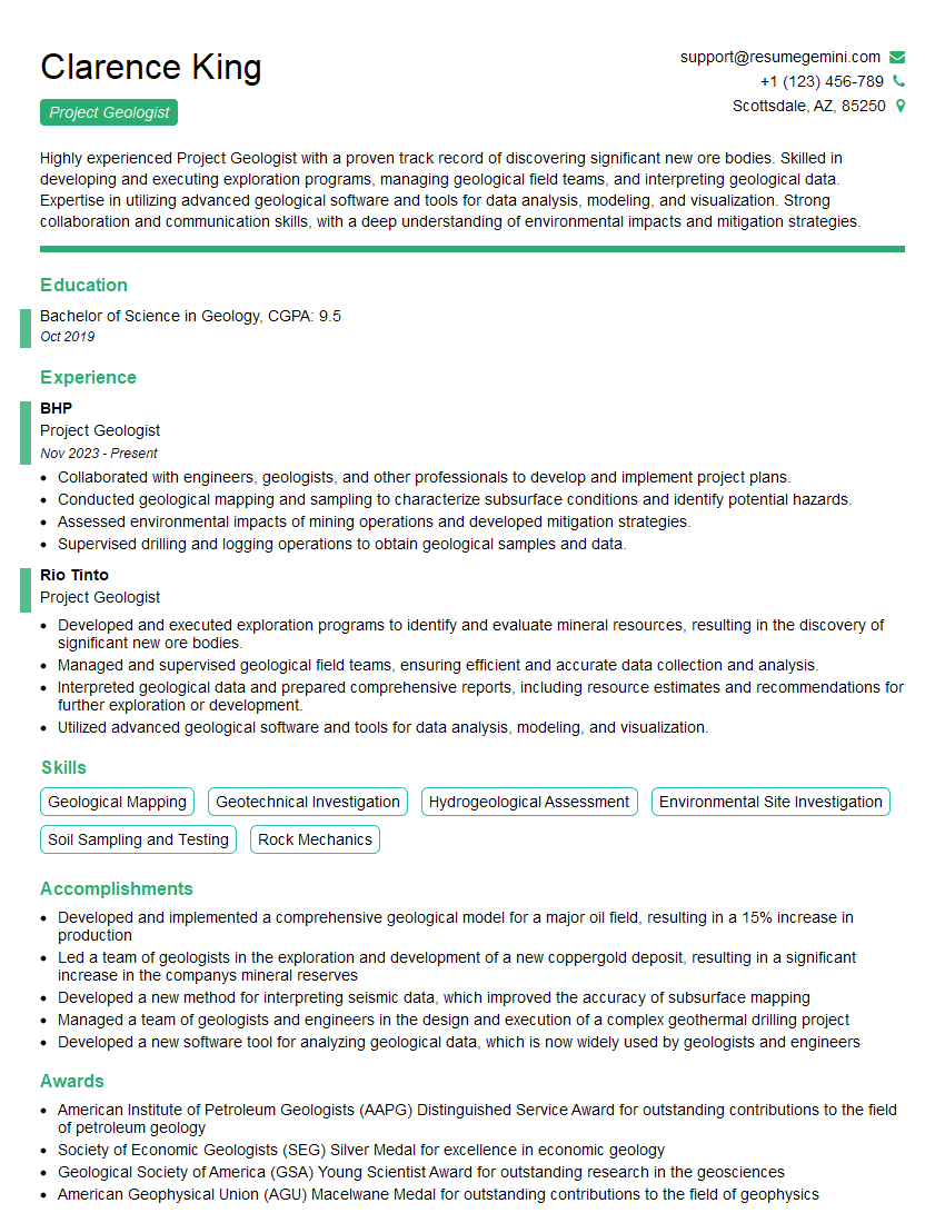
Feeling uncertain about what to expect in your upcoming interview? We’ve got you covered! This blog highlights the most important Site Characterization and Investigation interview questions and provides actionable advice to help you stand out as the ideal candidate. Let’s pave the way for your success.
Questions Asked in Site Characterization and Investigation Interview
Q 1. Describe the different phases involved in a typical site characterization project.
A typical site characterization project unfolds in several key phases, each building upon the previous one to provide a comprehensive understanding of the subsurface. Think of it like peeling back the layers of an onion to reveal the site’s secrets!
- Phase 1: Planning and Scoping: This initial phase involves defining project objectives, identifying potential environmental concerns, and reviewing existing data. We determine the necessary level of detail, the types of investigations needed, and the budget constraints. For example, a small residential development might require a less extensive investigation than a large-scale industrial project.
- Phase 2: Preliminary Site Investigation: This phase often involves a desktop study reviewing historical maps, aerial photographs, and environmental reports. It also includes a site reconnaissance walk-over to visually assess surface conditions and potential hazards. This helps focus subsequent field investigations.
- Phase 3: Subsurface Investigation: This is the core of the project, involving various techniques (discussed in the next question) to collect data about soil types, groundwater conditions, and potential contaminants. This might involve drilling boreholes, conducting geophysical surveys, or installing monitoring wells.
- Phase 4: Data Analysis and Interpretation: Collected data, such as borehole logs, laboratory test results, and geophysical data, are analyzed and interpreted to develop a conceptual site model. This involves integrating all findings to build a holistic understanding of the site.
- Phase 5: Reporting and Recommendations: The final phase involves preparing a comprehensive report summarizing findings, interpreting the data, and providing recommendations for design and construction. This report is crucial for engineers and designers to make informed decisions.
Q 2. Explain the methods used to determine soil properties (e.g., shear strength, permeability).
Determining soil properties is crucial for engineering design. We use a range of methods, each suited to specific properties. Imagine a doctor using different tools to diagnose a patient; we use different tests to understand soil behaviour.
- Shear Strength: This measures the soil’s resistance to deformation. Common tests include the
vane shear test(in-situ, for soft clays), thetriaxial test(laboratory, for a wide range of soils), and thedirect shear test(laboratory, simple and fast). The results are crucial for slope stability analysis and foundation design. - Permeability: This indicates how easily water flows through the soil. The
constant head permeability testand thefalling head permeability test(both laboratory tests) measure the rate of water flow under different hydraulic gradients. In-situ methods such asslug testsin boreholes are also used to estimate permeability. - Other Properties: Other important properties determined through laboratory and field tests include soil classification (e.g., using the Unified Soil Classification System), grain size distribution, moisture content, and density. These properties affect many aspects of construction, like foundation design, earthwork calculations and slope stability.
Q 3. What are the common types of subsurface investigations and their applications?
Subsurface investigations are like detective work, each technique revealing different aspects of the subsurface ‘crime scene’.
- Borehole Drilling: This is the most common method, involving drilling holes to collect soil and rock samples for laboratory testing. Different drilling methods (e.g., auger drilling, rotary drilling, percussion drilling) are used depending on the soil conditions and project requirements.
- Geophysical Surveys: These techniques use physical principles to image the subsurface without direct drilling.
Seismic refractionandreflection surveyshelp determine subsurface layers and identify potential hazards.Ground penetrating radar (GPR)is excellent for detecting shallow subsurface features like buried utilities or voids. - Cone Penetration Testing (CPT): A cone-shaped probe is pushed into the ground, measuring resistance to penetration. This provides continuous profiles of soil density and strength. It’s often used for rapid site assessment and for determining soil stratigraphy.
- In-situ Testing: These tests are performed directly in the ground, like the
Standard Penetration Test (SPT)which measures the resistance of soil to driving a sampler. This provides information on soil consistency and relative density.
The application depends on the project needs. For example, CPT is efficient for large-scale projects needing rapid assessments, while borehole drilling is necessary for detailed sampling and laboratory testing for specific contaminants.
Q 4. How do you select appropriate investigation techniques based on project goals and site conditions?
Selecting the right investigation technique is crucial for efficient and effective site characterization. It’s like choosing the right tool for a job – a hammer isn’t suitable for driving screws!
The selection process considers several factors:
- Project Goals: What information is needed? A foundation design requires detailed soil strength data, while a preliminary environmental assessment might only need a broad overview.
- Site Conditions: Soil type, groundwater level, presence of obstructions, and accessibility all affect the feasibility of different techniques. For example, bedrock might necessitate specialized drilling methods.
- Budget and Schedule: Some methods are more expensive or time-consuming than others. Balancing cost and information needs is vital.
- Regulatory Requirements: Environmental regulations may dictate specific investigation requirements.
A thorough risk assessment helps prioritise the investigations. For example, if there is a high probability of encountering contaminated soil, targeted sampling strategies and specific laboratory analyses are necessary.
Q 5. Discuss the importance of quality assurance and quality control (QA/QC) in site characterization.
QA/QC is essential for ensuring the reliability and integrity of the site characterization data. It’s like a quality control check in any manufacturing process – it ensures the final product is reliable and accurate.
- Sampling and Handling: Proper sampling procedures and chain of custody documentation are crucial to avoid sample contamination or misidentification. Samples must be collected and handled according to the relevant standards.
- Laboratory Testing: QA/QC in the laboratory involves using reference materials, conducting duplicate analyses, and participating in proficiency testing programs to maintain accuracy and precision.
- Data Management: Data should be systematically organized, documented, and checked for errors. Data management software can improve efficiency and accuracy.
- Field Verification: Regular checks of equipment calibration and field procedures ensure data quality. For example, checking the level of a borehole before drilling, and confirming the consistency of the drilling methods used.
A robust QA/QC program builds confidence in the data and ensures project success. Poor QA/QC can lead to costly mistakes in design and construction.
Q 6. How do you interpret borehole logs and geophysical data?
Interpreting borehole logs and geophysical data requires experience and understanding of geological principles. It’s like reading a map of the subsurface, interpreting the clues to build a complete picture.
- Borehole Logs: These records describe the soil and rock encountered during drilling, including depth, soil type, color, moisture content, and any observed features. Careful observation of changes in soil properties can reveal stratigraphy and potential engineering issues.
- Geophysical Data: Geophysical surveys produce images or profiles of the subsurface. These need careful analysis, often involving specialised software. Interpretation involves identifying different subsurface layers, locating faults or fractures, and detecting buried objects.
Integrating borehole logs and geophysical data provides a more complete picture. For example, a geophysical survey might identify a subsurface anomaly; a borehole drilled at that location can confirm its nature (e.g., a void, bedrock, or buried waste).
Q 7. Explain the process of developing a site characterization work plan.
Developing a site characterization work plan is like creating a detailed blueprint for an investigation. It ensures the project proceeds efficiently and delivers the required information.
The process usually includes:
- Defining Objectives: Clearly stating the project goals, the types of information needed, and the intended use of the data (e.g., foundation design, environmental assessment).
- Literature Review: Collecting and reviewing all available information on the site, such as historical maps, aerial photographs, and environmental reports.
- Site Reconnaissance: Conducting a site visit to assess surface conditions, identify potential hazards, and refine the investigation plan.
- Selection of Investigation Methods: Choosing appropriate methods based on the project objectives, site conditions, and budget constraints.
- Sampling and Testing Program: Specifying the number and location of samples, the types of laboratory tests needed, and the QA/QC procedures.
- Health and Safety Plan: Developing a detailed plan to ensure the safety of personnel during the field investigation.
- Schedule and Budget: Preparing a realistic schedule and budget for the project.
A well-defined work plan ensures a focused and efficient investigation, minimizing unnecessary costs and maximizing the value of the data collected.
Q 8. Describe your experience with different sampling techniques (e.g., Shelby tubes, split spoon samplers).
My experience encompasses a wide range of soil and groundwater sampling techniques. Shelby tubes, for instance, are ideal for obtaining relatively undisturbed samples, crucial for geotechnical analyses like shear strength testing and consolidation. They’re essentially thin-walled metal cylinders that are pushed into the ground, capturing a representative sample. However, their use is limited to cohesive soils; in sandy or gravelly formations, they’re often ineffective.
Split-spoon samplers, on the other hand, are more robust and used for a broader range of soil conditions. They provide disturbed samples, sufficient for grain size analysis and classification. The sampler is driven into the ground using a weight and hammer, and then split open to allow for visual inspection and sampling. The number of blows required to drive the sampler a specific distance provides an indication of the soil’s relative density or consistency (N-value in Standard Penetration Test, or SPT).
Beyond these, I’ve extensively used direct-push technologies for faster and more cost-effective site assessments, particularly for screening purposes. These methods are well-suited for environmental investigations and offer the advantage of obtaining continuous samples.
The choice of sampling technique always depends on the project objectives, soil conditions, and budget constraints. For example, a geotechnical investigation for a high-rise building might necessitate Shelby tube sampling for accurate geotechnical parameters, whereas an environmental site assessment for potential contaminants may employ direct-push methods.
Q 9. How do you handle unexpected site conditions during an investigation?
Handling unexpected site conditions is a critical aspect of site characterization. A well-planned investigation always incorporates contingency plans. For example, encountering unexpected bedrock at a shallower depth than anticipated would necessitate revising the drilling plan and potentially adjusting sampling strategies to include rock coring techniques. Similarly, encountering unexpectedly high groundwater levels might require modifying the sampling methods to avoid sample contamination or using specialized equipment for dewatering.
Communication is key. Immediately reporting the unexpected findings to the project team and client allows for collaborative decision-making. This includes documenting the deviation from the original plan, the impact on the project timeline and budget, and the proposed corrective actions. Thorough documentation is crucial to maintain the integrity of the investigation and support any subsequent remedial actions.
A recent project involved encountering a previously undocumented landfill during excavation. This required an immediate halt in work, a thorough assessment of the landfill extent and composition, and the development of a revised plan involving specialized handling procedures and potentially expanded sampling to assess potential contaminants.
Q 10. Explain the significance of groundwater monitoring in site characterization.
Groundwater monitoring is paramount in site characterization, especially for environmental investigations. It provides crucial information about the presence, concentration, and migration pathways of potential contaminants. Groundwater acts as a natural transport medium, carrying dissolved substances over considerable distances. Monitoring wells, strategically installed at various depths and locations, allow for the systematic collection of groundwater samples for analysis.
The data collected helps determine the extent and severity of contamination, assess the risk to human health and the environment, and inform the design of any necessary remediation strategies. Temporal monitoring allows us to track contaminant plumes over time, understanding their movement and assessing the effectiveness of remediation efforts. For instance, a decrease in contaminant concentration over time in a monitoring well near a remediation site indicates that the cleanup efforts are effective.
Q 11. How do you assess potential environmental contamination at a site?
Assessing potential environmental contamination requires a multi-faceted approach. It begins with a thorough review of historical records, including land use history, aerial photography, and available environmental reports, to identify potential sources of contamination. This is followed by a site reconnaissance to visually inspect the area for signs of contamination (e.g., staining, odours, presence of drums).
Next, a phased sampling and analysis program is implemented, starting with soil and groundwater sampling from potentially impacted areas. The selection of sampling locations is guided by the identified potential sources and the hydrogeology of the site. Samples are analyzed for a suite of parameters, depending on the suspected contaminants, following relevant regulatory guidelines.
Data interpretation involves comparing the measured concentrations to regulatory thresholds and background levels to determine if contamination exceeds acceptable limits. Statistical analysis techniques help to establish the significance of findings and delineate the extent of the impacted areas. Risk assessment methodologies are then used to evaluate the potential risks posed by the identified contaminants.
Q 12. What are the regulatory requirements for site characterization in your region?
Regulatory requirements for site characterization vary depending on location and the specific activity conducted at the site. However, in most jurisdictions, the overarching goal is to protect human health and the environment. Key regulations often include those governing hazardous waste management, environmental remediation, and groundwater protection. These regulations frequently outline specific requirements for sampling protocols, data reporting, and remedial actions.
For example, the [Insert relevant regional/national environmental agency, e.g., EPA in the US, Environment Agency in the UK] sets forth detailed guidelines for conducting site investigations, specifying required sampling depths, frequencies, and analytical methods. These guidelines are often accompanied by specific reporting requirements detailing the methodologies used, the results obtained, and a risk assessment of identified contaminants. Non-compliance can result in penalties and legal repercussions.
Staying abreast of the latest regulatory changes is critical for ensuring compliance and providing reliable and legally defensible reports.
Q 13. Discuss your experience with data analysis and reporting in site characterization projects.
Data analysis and reporting are integral parts of site characterization. My experience encompasses a range of analytical methods, including statistical analysis to identify trends and anomalies in the data, spatial analysis to map the extent of contamination plumes, and geochemical modeling to predict contaminant transport. Data visualization tools are heavily used to create clear and concise presentations of the data.
The final reports typically follow a structured format, including an executive summary, site description, methodology, results, data interpretation, conclusions, and recommendations. They are written to be clear and easily understandable, avoiding overly technical language, while also providing the necessary scientific rigor for informed decision-making.
Quality assurance and quality control measures are implemented throughout the data analysis and reporting process to maintain data integrity and ensure the accuracy of the conclusions. This includes verifying data against field observations, conducting peer reviews, and using validated analytical methods.
Q 14. How do you use GIS software in site characterization and investigation?
GIS software is invaluable in site characterization, providing a powerful platform for visualizing, analyzing, and managing spatial data. I regularly use GIS to map the site location, delineate sampling locations, create contour maps of contaminant concentrations, and model the potential migration of contaminants. This allows for a clear visual representation of the site conditions and facilitates informed decision-making.
For instance, GIS can be used to overlay various data layers, such as soil types, geology, topography, and contaminant concentration maps, to identify potential areas of concern and understand the factors influencing contaminant transport. The ability to integrate diverse datasets into a single, visually accessible format significantly enhances the interpretation of site conditions and supports the development of efficient and targeted sampling strategies. Furthermore, it facilitates clear and effective communication of complex data to stakeholders.
Q 15. Explain the concept of site-specific parameters and their importance in design.
Site-specific parameters are the unique geotechnical and environmental characteristics of a particular location. These parameters are crucial for safe and efficient design because they dictate how a structure will interact with the ground. Ignoring them can lead to significant problems, from settlement and foundation failure to environmental contamination.
For example, the type of soil (clay, sand, gravel), its strength, its permeability (how easily water flows through it), and the presence of groundwater all affect foundation design. A building designed for sandy soil might fail catastrophically if built on expansive clay, which swells and shrinks with changes in moisture content. Similarly, understanding the groundwater table is essential to prevent buoyancy problems or to design appropriate drainage systems. These parameters are determined through site characterization investigations and are used to inform the engineering design process, ensuring the structure is safe, stable, and cost-effective.
Another key aspect is the understanding of seismic parameters in earthquake-prone areas. The soil’s response to seismic waves influences the design of the foundation and the structure itself. Failing to account for these parameters can result in catastrophic structural failure during an earthquake.
Career Expert Tips:
- Ace those interviews! Prepare effectively by reviewing the Top 50 Most Common Interview Questions on ResumeGemini.
- Navigate your job search with confidence! Explore a wide range of Career Tips on ResumeGemini. Learn about common challenges and recommendations to overcome them.
- Craft the perfect resume! Master the Art of Resume Writing with ResumeGemini’s guide. Showcase your unique qualifications and achievements effectively.
- Don’t miss out on holiday savings! Build your dream resume with ResumeGemini’s ATS optimized templates.
Q 16. How do you manage risks associated with site characterization activities?
Managing risks in site characterization involves a multi-faceted approach. Firstly, a thorough planning phase is crucial, encompassing a comprehensive review of existing data, site reconnaissance, and identification of potential hazards. This might include reviewing historical maps, aerial photographs, and environmental reports to assess potential risks like contamination or unstable ground conditions. A detailed Health and Safety plan is essential, outlining procedures for handling potentially hazardous materials, ensuring worker safety with appropriate Personal Protective Equipment (PPE), and emergency response protocols.
Secondly, the selection of appropriate investigation methods is critical. The choice depends on the project’s scope and the perceived risks. For example, if contamination is suspected, specialized sampling techniques and laboratory analysis are necessary. A risk assessment matrix can help prioritize investigation activities. Regular quality control checks on sampling and testing procedures ensure data reliability and minimize error. Finally, clear communication channels with stakeholders throughout the process are vital for informed decision-making and transparent risk management.
Q 17. Describe your experience with different types of in-situ testing methods (e.g., CPT, DMT).
I have extensive experience with various in-situ testing methods, including Cone Penetration Testing (CPT) and the Dutch Cone Penetration Test (DMT). The CPT uses a cone penetrometer pushed into the ground, measuring the resistance to penetration. This provides continuous data on soil strength and stratigraphy. It’s relatively quick, cost-effective, and provides high-resolution data. DMT, on the other hand, measures both cone resistance and pore water pressure, offering insights into soil stiffness and its effective stress. It’s particularly useful for assessing the engineering properties of soft soils. I’ve used both methods on numerous projects, from small residential developments to large-scale infrastructure projects. For example, on a recent highway project, CPT data was crucial for designing the foundation depths for bridge abutments, ensuring they could withstand the anticipated traffic loads and soil conditions. The DMT helped us characterize the compressibility of the underlying layers, helping in design for settlement.
Q 18. How do you determine the depth of investigation required for a project?
Determining the required depth of investigation is a critical decision, impacting both project cost and safety. It’s not a one-size-fits-all answer; instead, it depends on several factors. The type of structure, its size, and its anticipated load are paramount. A skyscraper will naturally require far deeper investigations than a small house. The anticipated geotechnical conditions also play a significant role. Areas with complex geology or known issues (e.g., old landfills, fault lines) require more extensive investigation. Building codes and regulatory requirements also mandate minimum investigation depths. For instance, in areas prone to liquefaction, the investigation needs to reach depths below the liquefiable layer.
In practice, we often employ a tiered approach. Initial investigations might involve desk studies and shallow borings to characterize the upper layers. This is followed by deeper investigation if necessary. Engineering judgment, based on experience and professional standards, guides the determination. Ultimately, the goal is to gather enough data to design a safe and efficient structure while maintaining a reasonable budget.
Q 19. Explain the differences between intrusive and non-intrusive site investigation methods.
Intrusive and non-intrusive methods represent two distinct approaches to site investigation. Intrusive methods involve physically disturbing the ground, for instance, drilling boreholes, taking soil samples, or performing in-situ tests like CPT or DMT. These methods provide direct measurements and are generally preferred when detailed information is needed. However, they are more time-consuming, expensive, and can disrupt the site. Non-intrusive methods, conversely, don’t disturb the ground. Examples include geophysical surveys (e.g., ground-penetrating radar), remote sensing (e.g., aerial photography), and surface wave testing. These are usually quicker and less expensive but often provide less detailed data. They are valuable for initial site reconnaissance and preliminary assessment, often used before employing more intrusive methods to focus subsequent investigations to specific areas of interest.
The choice between the two approaches often depends on the project’s specific needs and budget. A large-scale project might start with non-intrusive methods to get an overview, followed by targeted intrusive methods in critical areas. A small residential project may only need limited intrusive investigation.
Q 20. Describe your experience with environmental regulations and permitting requirements.
Navigating environmental regulations and permitting requirements is a crucial part of site characterization. My experience encompasses working with various agencies and complying with local, state, and federal regulations. This involves understanding the specific rules regarding soil and groundwater contamination, handling hazardous materials, and proper waste disposal. Prior to any field work, we prepare detailed plans that adhere to all applicable regulations, including obtaining all necessary permits. We ensure the collection and analysis of samples are performed by accredited laboratories following established protocols. Thorough documentation of all activities, including chain of custody for samples and disposal records, is maintained to ensure compliance and transparency. Any findings of contamination are reported to the relevant authorities promptly, following established reporting requirements, and remediation plans are developed and implemented as required.
For example, on a project near a former industrial site, we had to follow stringent protocols for handling potentially contaminated soil, including special sampling and handling procedures to prevent cross-contamination and protect worker safety. We also had to obtain specialized permits for waste disposal and remediation.
Q 21. How do you communicate technical information effectively to both technical and non-technical audiences?
Effective communication is vital in my field. I approach this by tailoring my communication style to the audience. When communicating with technical audiences, I use precise terminology and focus on technical details. However, when communicating with non-technical stakeholders (e.g., clients, community members), I simplify the technical jargon using analogies, visual aids (e.g., charts, diagrams), and plain language. I always ensure that the information is presented accurately and understandably, avoiding the use of excessive technical terminology without explanation. I find that a combination of written reports, presentations, and interactive discussions proves highly effective in getting the message across clearly.
For instance, when presenting to clients, I use clear visualizations to illustrate complex geotechnical concepts and ensure the overall report is easy to follow. In meetings with engineers, I employ more technical language and detail to ensure everyone is on the same page regarding the data interpretation and design implications.
Q 22. What is your experience with remediation technologies and their selection criteria?
Remediation technology selection is a critical step in any contaminated site project. It hinges on understanding the nature and extent of the contamination, the site’s hydrogeology, and regulatory requirements. My experience encompasses a wide range of technologies, including pump and treat for groundwater remediation, bioremediation leveraging naturally occurring microbes to break down contaminants, soil vapor extraction for volatile organic compounds, and in-situ chemical oxidation for treating non-aqueous phase liquids.
The selection process is never arbitrary. We follow a structured approach, starting with a thorough site characterization to define the contaminant’s type, concentration, and spatial distribution. Then, we assess the feasibility of various technologies based on factors like cost-effectiveness, effectiveness in addressing the specific contaminants, potential impacts on surrounding environments, and regulatory compliance. For instance, if we’re dealing with high concentrations of volatile organic compounds in shallow soil, soil vapor extraction would likely be a superior option compared to bioremediation which may be more suitable for persistent, less volatile contaminants. Risk assessment also plays a crucial role, ensuring that the chosen technology minimizes any potential risks to human health and the environment. Ultimately, the optimal technology is the one that provides the most effective and sustainable solution within the given constraints.
Q 23. How do you ensure the safety of field personnel during site investigations?
Safety is paramount in all our site investigations. We implement a comprehensive safety program that begins with thorough training for all field personnel, covering topics such as hazard identification, personal protective equipment (PPE) use, emergency response procedures, and site-specific risks. This training isn’t a one-time event; it’s regularly updated to reflect changes in projects and best practices.
Before any fieldwork commences, we conduct detailed site-specific risk assessments, identifying potential hazards like confined spaces, heavy machinery, hazardous materials, and potential for slips, trips, and falls. Based on this assessment, we develop a site-specific safety plan, which includes emergency procedures, communication protocols, and detailed roles and responsibilities for each team member. We also utilize various safety monitoring systems, such as real-time location tracking for personnel and gas monitoring equipment to detect any hazardous airborne substances. Regular toolbox talks and safety briefings are also conducted to reinforce best practices and address emerging issues. Our commitment to safety results in a proactive approach, aiming to prevent accidents before they happen rather than reacting to them.
Q 24. Explain your experience in managing budgets and schedules for site characterization projects.
Effective budget and schedule management are essential for successful site characterization projects. My experience involves developing detailed budgets that accurately reflect the costs associated with all aspects of the project, including personnel, equipment, laboratory analysis, and permitting. I utilize various project management software tools to track expenses and ensure that the project stays within the allocated budget.
Similarly, I develop realistic project schedules using critical path method (CPM) analysis, identifying key tasks and their dependencies. This allows for proactive identification of potential delays and mitigation strategies. Regular progress meetings are held with the project team to monitor progress against the schedule and budget, identifying and addressing any potential issues promptly. These meetings involve open communication and collaboration to ensure transparency and efficient problem-solving. For instance, I’ve successfully managed projects where unexpected subsurface conditions were encountered, necessitating changes to the scope and timeline. Through effective communication and collaboration with the client and the project team, we were able to adjust the budget and schedule without compromising the quality of the work or exceeding the overall project cost.
Q 25. Describe a challenging site characterization project you worked on and how you overcame the challenges.
One particularly challenging project involved characterizing a site with complex geology and highly variable contamination levels. The site was located near an old industrial facility, and the subsurface conditions included highly fractured bedrock, variable soil layers, and a complex network of abandoned underground structures. The initial investigation methods proved inadequate for comprehensively characterizing the site’s heterogeneity.
To overcome these challenges, I implemented a phased approach, starting with a reconnaissance investigation to obtain preliminary data and identify areas requiring more detailed investigation. Then we employed a combination of techniques, including geophysical surveys (electrical resistivity tomography and ground-penetrating radar) to map the subsurface geology and identify the location of potential contaminants. We also utilized advanced drilling methods, such as direct push technology, to obtain high-resolution subsurface data while minimizing soil disturbance. Furthermore, I collaborated closely with geologists and hydrogeologists to interpret the data and develop a reliable hydrogeological model. By adapting our methodology throughout the project based on the data acquired, we successfully completed the characterization and delivered a robust assessment that informed the subsequent remediation strategy. This iterative approach ensures optimal resource allocation and high data quality.
Q 26. How familiar are you with different types of soil classification systems (e.g., Unified Soil Classification System)?
I’m very familiar with the Unified Soil Classification System (USCS), a widely used system for classifying soils based on their grain size distribution and plasticity characteristics. Understanding soil classification is fundamental to site characterization, as it influences factors such as bearing capacity, permeability, and potential for contaminant migration. The USCS categorizes soils into various groups, such as gravels (G), sands (S), silts (M), clays (C), and organic soils (O), each with further subdivisions based on properties like plasticity index and grain size.
For example, a soil classified as SM indicates a silty sand, signifying a mixture of sand and silt. Knowing the USCS classification informs decisions related to engineering design, construction, and remediation. For example, a clay soil (CL) might require special consideration in foundation design because of its low permeability. This knowledge influences the selection of appropriate investigation methods and the interpretation of the resulting data. My experience also includes familiarity with other classification systems, such as the AASHTO system, which is relevant for pavement design and construction.
Q 27. Explain the importance of proper documentation and record keeping in site characterization.
Proper documentation and record-keeping are crucial for the integrity and defensibility of any site characterization project. Comprehensive documentation ensures that the data collected is accurate, reliable, and can be used to support decision-making in the future. This includes maintaining detailed field logs that record all activities, including locations of samples, drilling methods, observations, and any equipment used.
Chain of custody documentation is essential to guarantee the integrity of samples collected. This includes careful labeling of samples, secure transport to the laboratory, and tracking of the samples throughout the analytical process. Digital data management is critical, ensuring the integrity, accessibility, and security of digital data acquired from geophysical surveys, borehole logs, and laboratory analyses. The use of Geographic Information Systems (GIS) is highly beneficial in creating detailed maps and visualizing spatial relationships of the data. By implementing robust record-keeping practices, we build a complete and transparent record that provides a foundation for informed decision-making in future phases of the project and supports regulatory compliance.
Q 28. How do you incorporate stakeholder input into the site characterization process?
Stakeholder engagement is crucial for successful site characterization. It ensures that the project addresses the concerns and needs of all parties involved, including the client, regulatory agencies, and the community. I typically start by clearly identifying all stakeholders, understanding their respective interests and concerns.
This is often done through initial meetings and presentations outlining the project’s objectives, methodology, and schedule. We use a variety of communication channels, including regular meetings, newsletters, and public forums, to keep stakeholders informed of the project’s progress. I find that incorporating stakeholder feedback throughout the project helps to build trust and ensures that the final characterization report effectively addresses their needs. For example, if local residents have concerns about potential impacts on groundwater, we might include additional sampling and analysis to address those concerns and demonstrate that the project is conducted responsibly and transparently. This participatory approach ensures that the project outcome is widely accepted and that the site characterization provides a sound basis for informed decision-making.
Key Topics to Learn for Site Characterization and Investigation Interview
- Phase I Environmental Site Assessments (ESAs): Understanding the scope, limitations, and deliverables of Phase I ESAs, including the All Appropriate Inquiries (AAI) rule and historical research methods.
- Phase II Environmental Site Assessments: Practical application of sampling strategies (soil, groundwater, vapor), laboratory analysis interpretation, and data validation in Phase II investigations. Understanding data quality objectives (DQOs).
- Remediation Technologies: Familiarity with various remediation techniques (e.g., pump and treat, bioremediation, soil vapor extraction) and their suitability for different contaminants and site conditions.
- Data Analysis and Interpretation: Demonstrating proficiency in interpreting environmental data, identifying trends, and drawing conclusions based on statistical analysis and regulatory guidelines.
- Regulatory Compliance: Knowledge of relevant environmental regulations (e.g., CERCLA, RCRA) and reporting requirements for site characterization and investigation projects.
- Health and Safety: Understanding and application of relevant health and safety protocols in fieldwork, including personal protective equipment (PPE) and emergency response procedures.
- Geotechnical Considerations: Understanding the relationship between subsurface geology and contaminant transport. Interpreting boring logs and other geotechnical data.
- Report Writing and Communication: Ability to clearly and concisely communicate technical information in written reports and presentations, tailored to different audiences (technical and non-technical).
- Project Management Fundamentals: Demonstrating an understanding of project planning, budgeting, scheduling, and risk management within the context of environmental site investigations.
Next Steps
Mastering Site Characterization and Investigation is crucial for career advancement in environmental consulting, engineering, and remediation. A strong understanding of these principles opens doors to specialized roles and leadership opportunities. To maximize your job prospects, crafting an ATS-friendly resume is essential. ResumeGemini is a trusted resource to help you build a professional and impactful resume that highlights your skills and experience effectively. Examples of resumes tailored to Site Characterization and Investigation are available to help guide you through the process. Invest in your future – create a resume that reflects your expertise and secures your next interview.
Explore more articles
Users Rating of Our Blogs
Share Your Experience
We value your feedback! Please rate our content and share your thoughts (optional).
What Readers Say About Our Blog
Hello,
We found issues with your domain’s email setup that may be sending your messages to spam or blocking them completely. InboxShield Mini shows you how to fix it in minutes — no tech skills required.
Scan your domain now for details: https://inboxshield-mini.com/
— Adam @ InboxShield Mini
Reply STOP to unsubscribe
Hi, are you owner of interviewgemini.com? What if I told you I could help you find extra time in your schedule, reconnect with leads you didn’t even realize you missed, and bring in more “I want to work with you” conversations, without increasing your ad spend or hiring a full-time employee?
All with a flexible, budget-friendly service that could easily pay for itself. Sounds good?
Would it be nice to jump on a quick 10-minute call so I can show you exactly how we make this work?
Best,
Hapei
Marketing Director
Hey, I know you’re the owner of interviewgemini.com. I’ll be quick.
Fundraising for your business is tough and time-consuming. We make it easier by guaranteeing two private investor meetings each month, for six months. No demos, no pitch events – just direct introductions to active investors matched to your startup.
If youR17;re raising, this could help you build real momentum. Want me to send more info?
Hi, I represent an SEO company that specialises in getting you AI citations and higher rankings on Google. I’d like to offer you a 100% free SEO audit for your website. Would you be interested?
Hi, I represent an SEO company that specialises in getting you AI citations and higher rankings on Google. I’d like to offer you a 100% free SEO audit for your website. Would you be interested?
good


