Preparation is the key to success in any interview. In this post, we’ll explore crucial Interstate Highway Design interview questions and equip you with strategies to craft impactful answers. Whether you’re a beginner or a pro, these tips will elevate your preparation.
Questions Asked in Interstate Highway Design Interview
Q 1. Explain the design process for a typical interstate highway section.
Designing an interstate highway section is a multifaceted process involving numerous stages, from initial planning to final construction. It begins with a comprehensive needs assessment, identifying traffic volumes, projected growth, and regional connectivity requirements. This feeds into the preliminary design phase, where potential alignments and geometric design elements are explored. This involves utilizing software like MicroStation or AutoCAD Civil 3D to create preliminary designs.
- Route Selection: Factors like topography, environmental impact, and land acquisition costs influence the chosen route. For example, a route avoiding environmentally sensitive areas might be preferred even if it’s slightly longer.
- Geometric Design: This stage defines the highway’s horizontal and vertical alignment (curves, grades), lane widths, shoulder widths, and sight distances. Safety is paramount here, ensuring drivers have adequate time to react to changing conditions.
- Drainage Design: Effective drainage systems prevent water accumulation on the roadway, preserving pavement integrity and ensuring safety. This involves designing culverts, ditches, and storm drains.
- Pavement Design: Selecting appropriate pavement materials and thicknesses based on anticipated traffic loads and climate conditions. This is crucial for long-term pavement life and minimizing maintenance costs.
- Interchange Design: If the section includes interchanges, detailed designs are developed for ramps, bridges, and signalization to optimize traffic flow and safety. Roundabouts are sometimes utilized to reduce conflict points and improve efficiency.
- Environmental Impact Assessment: A thorough assessment evaluates the potential environmental consequences of the project, and mitigation strategies are implemented to minimize harm. This could include noise barriers, wildlife crossings, and wetland protection measures.
- Construction Drawings and Specifications: Detailed drawings and specifications are created to guide the construction process. This documentation is crucial for ensuring the final product adheres to the design intent.
The entire process is iterative, with designs refined and adjusted based on feedback from various stakeholders and further analysis. Each stage requires meticulous attention to detail and adherence to standards like those published by the American Association of State Highway and Transportation Officials (AASHTO).
Q 2. Describe different pavement design types and their applications.
Pavement design is critical for ensuring the long-term functionality and safety of a highway. Different pavement types cater to varying traffic loads, environmental conditions, and budget constraints.
- Flexible Pavements: These are constructed using layers of asphalt concrete and aggregate base and subbase materials. They are more adaptable to settlement and less rigid than rigid pavements. They’re cost-effective for lower volume roads and are widely used across interstate systems.
- Rigid Pavements: These consist of reinforced concrete slabs. They are highly durable and resistant to fatigue cracking, making them suitable for heavy traffic volumes. However, they are more expensive and less adaptable to uneven settlement, often used on high-speed, high-volume interstate sections.
- Composite Pavements: These combine aspects of both flexible and rigid pavements, often using a concrete base layer topped with an asphalt concrete surface. This design takes advantage of both material strengths, providing a durable and cost-effective solution.
The selection of a pavement type depends on several factors. For instance, a high-traffic urban interstate section might benefit from a rigid pavement, while a rural interstate with moderate traffic may utilize a flexible pavement design. The climate also plays a significant role; in regions with frequent freeze-thaw cycles, careful consideration is given to material selection to prevent damage from frost heaves. I have personally overseen projects where we opted for composite pavements in areas with heavy truck traffic and variable temperature conditions.
Q 3. How do you incorporate environmental considerations into highway design?
Environmental considerations are integrated throughout the entire highway design process, not as an afterthought. This involves a holistic approach, aiming to minimize the project’s environmental footprint.
- Environmental Impact Assessment (EIA): A thorough EIA identifies potential environmental impacts, such as habitat loss, water pollution, and noise pollution. This assessment informs mitigation strategies and helps in selecting the least environmentally damaging route.
- Mitigation Measures: Strategies employed to minimize adverse impacts might include constructing wildlife crossings (underpasses or overpasses) to maintain wildlife connectivity, implementing noise barriers to reduce noise pollution near residential areas, and using environmentally friendly construction materials.
- Wetland Protection: Avoiding or minimizing wetland impacts is crucial. Designs often incorporate measures such as constructing bridges or elevated roadways to avoid disturbing these delicate ecosystems.
- Water Quality Management: Strategies focus on preventing erosion and sediment runoff into nearby waterways. This may involve using erosion control blankets, sediment basins, and other best management practices.
- Air Quality Considerations: Strategies to minimize air pollution from construction activities and vehicle emissions include optimizing traffic flow to reduce idling and implementing emission control measures for construction equipment.
In one project, we successfully incorporated a greenway along a new interstate section, providing a recreational space for the community while also minimizing the visual impact of the highway. This demonstrates the potential for highway design to integrate environmental stewardship and community benefits.
Q 4. What are the key factors influencing highway alignment?
Highway alignment is a critical aspect of design, impacting safety, cost, and environmental impact. Several key factors influence the decision-making process.
- Topography: The terrain significantly shapes the alignment. Steep slopes, mountains, and valleys dictate the route’s vertical and horizontal geometry, potentially increasing construction costs and complexity.
- Environmental Constraints: Protecting environmentally sensitive areas, like wetlands and forests, often influences the alignment. Routes that avoid or minimize impact on these areas are prioritized.
- Land Use and Development: The existing land use and future development plans influence the alignment. Minimizing disruption to existing communities and infrastructure is crucial.
- Right-of-Way Acquisition: The availability and cost of land for the highway corridor influence the alignment. Routes requiring less land acquisition are generally preferred due to cost efficiency.
- Safety: Designing for optimal sight distance, minimizing sharp curves, and providing adequate stopping sight distance are essential for ensuring driver safety.
- Geotechnical Conditions: Soil conditions and stability influence the design, impacting foundation requirements and construction methods. Areas with unstable soil may necessitate additional engineering measures.
Balancing these often competing factors requires careful consideration and analysis. For example, a shorter route might be more costly due to challenging terrain and extensive right-of-way acquisition, while a longer route through less challenging terrain might be more environmentally friendly but increase travel time. This necessitates a thorough cost-benefit analysis considering all factors.
Q 5. Explain the importance of horizontal and vertical curves in highway design.
Horizontal and vertical curves are integral to highway design, influencing safety, driver comfort, and aesthetics. They provide a transition between straight sections of the road, preventing abrupt changes in direction or grade.
- Horizontal Curves: These are used to change the horizontal direction of the road. The design must consider factors such as curve radius, superelevation (banking of the road), and sight distance. Insufficient radius can lead to vehicle rollovers, while inadequate superelevation can result in skidding.
- Vertical Curves: These are used to transition between different gradients (slopes) of the road. They are designed to ensure a smooth transition, providing adequate sight distance and avoiding discomfort to drivers.
The design of curves adheres to AASHTO standards, ensuring driver safety and comfort. For instance, the minimum radius of a horizontal curve is determined based on design speed and the amount of superelevation. Similarly, the length of a vertical curve depends on the rate of change in grade and design speed, ensuring vehicles can safely navigate the change in elevation. I’ve been involved in numerous projects where optimizing curve design has been critical to mitigating safety risks and enhancing driver experience.
Q 6. Describe your experience with highway drainage design.
Highway drainage design is crucial for ensuring the long-term structural integrity and safety of the roadway. Poor drainage can lead to pavement damage, reduced visibility, and even accidents. My experience encompasses all aspects of drainage system design.
- Hydraulic Calculations: Determining the capacity of drainage structures (culverts, ditches, storm drains) to handle expected runoff volumes during various rainfall events is crucial. Software like HEC-RAS or HY8 is utilized for these computations.
- Drainage System Layout: Designing a network of ditches, inlets, pipes, and other structures to effectively collect and convey stormwater away from the roadway. The design must ensure adequate flow capacity and minimize erosion.
- Erosion and Sediment Control: Implementing measures to prevent erosion of the road surface and embankments, and to control sediment runoff into nearby water bodies. This could involve using vegetated swales, riprap, and other erosion control techniques.
- Hydraulic Structures: Designing hydraulic structures like culverts, bridges, and storm drains requires detailed hydraulic and structural analysis to ensure their capacity and stability. We frequently employ specialized software for modeling and design.
I’ve been directly involved in designing drainage systems for various interstate highway projects, including situations where we had to overcome complex hydrological conditions and tight environmental constraints. In one instance, we integrated a bioretention area into the design, providing a natural solution for managing stormwater while improving water quality.
Q 7. How do you ensure highway designs meet AASHTO standards?
AASHTO (American Association of State Highway and Transportation Officials) standards provide a framework for consistent and safe highway design. Ensuring compliance is crucial.
- AASHTO Green Book: This guide, formally known as the *AASHTO Guide for Design of Pavement Structures*, provides detailed specifications for pavement design, including material selection, thickness, and structural design. We meticulously follow these guidelines during design.
- AASHTO Geometric Design Guide: This guide covers the geometric design elements of highways, such as horizontal and vertical alignment, sight distances, and intersection design. Strict adherence to these standards is essential for safety and functionality.
- Quality Control: Implementing rigorous quality control measures during design and construction is crucial to ensure that the final product meets the required AASHTO standards. This involves regular inspections and testing of materials.
- Software Compliance: Ensuring that the design software used adheres to AASHTO standards and updates is equally vital. Using approved software ensures designs are based on validated calculations and methodologies.
- Peer Reviews: Conducting peer reviews of designs by independent experts provides an additional check to ensure that the designs meet AASHTO standards and best practices.
My experience encompasses working on several projects where strict adherence to AASHTO standards was not just a requirement but a cornerstone of success. Non-compliance could lead to safety issues, structural failures, and legal ramifications. Therefore, we are always proactive in ensuring each design is rigorously checked against AASHTO standards.
Q 8. What software are you proficient in for highway design (e.g., AutoCAD, Civil 3D)?
My proficiency in highway design software is extensive. I’m highly skilled in AutoCAD Civil 3D, a crucial tool for creating detailed highway designs, including alignments, profiles, cross-sections, and earthworks. I also have experience with other software packages such as MicroStation and OpenRoads Designer, allowing me to adapt to different project requirements and client preferences. Beyond the core design software, I’m proficient in utilizing software for hydraulic modeling (HEC-RAS, for example), geotechnical analysis (e.g., Plaxis), and traffic simulation (like VISSIM). This multifaceted software knowledge allows me to tackle all aspects of a highway project efficiently and effectively.
Q 9. Explain your understanding of geometric design elements in highways.
Geometric design is the backbone of safe and efficient highway systems. It involves defining the horizontal and vertical alignments, which dictate the route’s path and its elevation changes. Key elements include:
- Horizontal Alignment: This refers to the plan view of the roadway, encompassing curves (circular, spiral, or compound), tangents, and intersections. Designing these elements considers factors like design speed, sight distance, and curve radii to ensure driver safety and comfort. For example, a tighter curve radius might be appropriate for a low-speed residential area, while a larger radius would be used for a high-speed interstate.
- Vertical Alignment: This defines the roadway’s elevation profile, including grades (slopes), vertical curves (connecting different grades), and intersections. Proper vertical alignment minimizes driver fatigue and ensures adequate sight distance, particularly over crests and sags. Understanding the relationship between grade and stopping sight distance is critical to safe design.
- Cross-Section Design: This specifies the geometry of the roadway’s width, lanes, shoulders, and drainage features. This element considers the number of lanes, pavement design, and appropriate setbacks for safety and utility access.
Effective geometric design minimizes conflict points, optimizes sight distance, and provides a smooth and predictable driving experience. Ignoring these principles can result in accidents, increased construction costs, and driver discomfort.
Q 10. Describe your experience with hydraulic modeling in highway design.
Hydraulic modeling is essential for designing safe and effective drainage systems for highways. My experience primarily involves using HEC-RAS (Hydrologic Engineering Center’s River Analysis System) to model water flow in culverts, bridges, and channels adjacent to roadways. I’ve used this software to analyze floodplains, determine the capacity of drainage structures, and assess the impact of highway construction on existing waterways. A recent project involved modeling the impact of a new highway overpass on a nearby river during a 100-year flood event. The model helped to optimize the design of the bridge culverts to ensure adequate flow capacity and prevent flooding in the surrounding area. This demonstrates the crucial role of hydraulic modeling in mitigating flood risks and ensuring the longevity of highway infrastructure. Understanding the intricacies of water flow and the potential impacts on the environment is crucial for responsible highway design.
Q 11. How do you handle soil mechanics considerations in highway design?
Soil mechanics plays a critical role in determining the stability and performance of highway pavements and embankments. My approach starts with a thorough geotechnical investigation, including soil sampling and laboratory testing to determine soil properties like shear strength, consolidation characteristics, and permeability. This data informs the design of the pavement structure, including the subgrade, subbase, base, and surface layers. For example, a weak subgrade might necessitate the use of a thicker base layer or geosynthetics to improve its stability and bearing capacity. Similarly, understanding soil drainage characteristics is crucial for designing effective drainage systems to prevent pavement failures due to frost heave or water saturation. I also use software like Plaxis to model soil behavior under various loading conditions, ensuring the stability of slopes and embankments. This allows for optimized designs that minimize settlement and prevent potential failures.
Q 12. Explain your understanding of traffic engineering principles.
Traffic engineering principles are integral to designing highways that operate safely and efficiently. This includes understanding traffic flow characteristics, analyzing traffic volumes, and predicting future traffic demand. Key aspects include:
- Capacity Analysis: Determining the number of vehicles a roadway segment can handle without significant congestion.
- Level of Service (LOS): Evaluating the quality of traffic flow based on speed, density, and delay.
- Signal Timing and Design: Optimizing signal timing to minimize delays and improve traffic flow at intersections.
- Geometric Design for Traffic Operations: Designing appropriate lane widths, sight distances, and intersection geometry to accommodate traffic flow.
For instance, a recent project involved analyzing the traffic impact of a proposed highway widening. This included using simulation software to model traffic flow under various scenarios and identifying potential bottlenecks. The analysis informed the final design, ensuring sufficient capacity to handle projected traffic growth.
Q 13. How do you incorporate safety features into highway design?
Safety is paramount in highway design. I integrate safety features throughout the design process, considering both geometric and operational aspects. Examples include:
- Sight Distance Considerations: Ensuring adequate sight distance along curves and at intersections to allow drivers sufficient time to react.
- Clear Zones: Providing sufficient roadside space for errant vehicles to recover without impacting fixed objects.
- Appropriate Curve Design: Utilizing superelevation and proper curve radii to mitigate the risk of run-off-road accidents.
- Intersection Design: Employing roundabouts or other safety features to improve traffic control and reduce the severity of collisions.
- Median Barriers: Incorporating median barriers to prevent cross-median crashes.
- Lighting and Signage: Utilizing appropriate lighting and signage to enhance driver awareness and reduce risk.
By proactively addressing safety in the design phase, we can significantly reduce the likelihood of accidents and improve overall highway safety.
Q 14. Describe your experience with highway construction sequencing.
Highway construction sequencing is crucial for efficient and safe project execution. It involves carefully planning the order of construction activities to minimize disruptions, optimize resource allocation, and ensure the timely completion of the project. This includes considering factors like:
- Phasing: Breaking down the project into manageable phases, allowing for staged openings of sections of the roadway.
- Logistics: Planning the delivery of materials and equipment to minimize delays.
- Workforce Management: Efficiently scheduling crews and subcontractors.
- Environmental Considerations: Implementing measures to minimize environmental impact during construction.
- Safety Protocols: Ensuring compliance with safety regulations and establishing safe working conditions.
For example, a recent project involved coordinating the construction of a new highway overpass while maintaining traffic flow on the existing roadway. This required careful planning and phasing of activities to minimize disruption to traffic and ensure the safety of construction workers. Effective sequencing reduces overall project duration and costs while optimizing safety throughout the construction phase.
Q 15. Explain your experience with cost estimation in highway projects.
Cost estimation in highway projects is a crucial aspect, requiring a detailed understanding of various factors influencing the final price. It’s not just about adding up material costs; it involves a comprehensive analysis encompassing design complexity, geographical considerations, environmental impacts, and potential unforeseen challenges.
My experience involves using a variety of methods, from preliminary estimates based on unit costs and historical data to more sophisticated techniques like parametric estimating (where cost is correlated with key project parameters like length and number of lanes) and detailed quantity take-offs from construction drawings. For example, on a recent project involving a highway widening, I used a combination of unit cost estimating for earthwork and pavement, parametric modeling for bridge construction (based on span length and type), and detailed cost analysis for specialized features like intelligent transportation systems (ITS).
Risk assessment is integral to cost estimation. We build contingency buffers into the cost estimates to account for potential inflation, unforeseen site conditions (like encountering unexpected bedrock during excavation), and changes in project scope. Transparency is key – I ensure that the cost breakdown is clearly documented and justifiable to stakeholders.
Career Expert Tips:
- Ace those interviews! Prepare effectively by reviewing the Top 50 Most Common Interview Questions on ResumeGemini.
- Navigate your job search with confidence! Explore a wide range of Career Tips on ResumeGemini. Learn about common challenges and recommendations to overcome them.
- Craft the perfect resume! Master the Art of Resume Writing with ResumeGemini’s guide. Showcase your unique qualifications and achievements effectively.
- Don’t miss out on holiday savings! Build your dream resume with ResumeGemini’s ATS optimized templates.
Q 16. How do you manage project schedules and budgets for highway design?
Managing project schedules and budgets for highway design requires a robust project management framework. This typically involves utilizing project management software (like Primavera P6 or Microsoft Project) to create a detailed work breakdown structure (WBS) and critical path method (CPM) schedule. The WBS breaks down the project into manageable tasks, and CPM identifies the sequence of tasks that determines the overall project duration.
Budget management involves developing a detailed budget based on the cost estimate, tracking actual expenditures against the budget, and implementing corrective actions if necessary. Earned Value Management (EVM) is a powerful technique I employ to monitor project performance and forecast potential cost overruns or schedule delays. For instance, on a recent project, we used EVM to identify a potential delay in bridge construction due to material supply chain issues. By proactively addressing the issue – through expediting material delivery – we managed to stay on schedule without exceeding the budget. Regular progress meetings, involving all stakeholders, are crucial for proactive management and conflict resolution.
Q 17. Describe your experience with public involvement in highway projects.
Public involvement is paramount in highway projects. It’s not just a box to check; it’s crucial for ensuring the project aligns with community needs and minimizing negative impacts. My approach involves a multi-faceted strategy, starting with early and frequent communication with the public. This includes public forums, open houses, online surveys, and targeted outreach to affected communities.
For example, during a recent project near a residential area, we conducted a series of neighborhood meetings to address residents’ concerns regarding noise pollution and traffic congestion. We incorporated their feedback into the design, including noise barriers and traffic calming measures. Active listening and transparent communication are essential – addressing concerns honestly, even if it means modifying the project plans, fosters trust and ultimately leads to a more successful outcome. Documenting all public interaction and feedback is vital for accountability and regulatory compliance.
Q 18. How do you handle conflicts between design and environmental requirements?
Conflicts between design and environmental requirements are common in highway projects. Resolving these requires a balanced approach that prioritizes environmental protection while ensuring the project’s functionality and safety. This often involves creative problem-solving and leveraging interdisciplinary expertise.
For instance, if a proposed highway alignment impacts a sensitive wetland, we might explore alternative alignments or mitigation strategies, such as constructing wetlands elsewhere to compensate for the loss. This might necessitate engaging environmental consultants and regulatory agencies to conduct environmental impact assessments and obtain necessary permits. The key is to find solutions that are environmentally sound, technically feasible, and acceptable to all stakeholders. Compromise and collaboration are crucial; sometimes, it means scaling down aspects of the design to minimize ecological disruption.
Q 19. Explain your experience with bridge design and integration into highway projects.
Bridge design and integration are critical aspects of highway projects, demanding both structural and aesthetic considerations. My experience encompasses all phases, from preliminary design and structural analysis to detailed design and construction drawings. I’m proficient in using various software packages for structural modeling and analysis (like ETABS or SAP2000) to ensure the bridge design meets safety and serviceability criteria.
I’ve been involved in projects ranging from simple girder bridges to complex cable-stayed bridges. Integration with the highway requires careful consideration of the bridge’s approach ramps, alignment with existing roadways, and compatibility with the surrounding environment. For example, on a recent project, we used a design that minimized the visual impact of the bridge on a nearby park by incorporating natural elements into the bridge’s design and landscaping the surrounding area. Coordination with geotechnical engineers is vital to ensure the bridge foundation is suitable for the soil conditions.
Q 20. How do you address challenges related to right-of-way acquisition?
Right-of-way acquisition is a complex process involving legal, social, and economic considerations. It requires careful planning and coordination with legal counsel, property owners, and appraisal professionals. Challenges often arise from disagreements on property values, relocation issues, and navigating legal procedures.
My approach prioritizes transparency and fairness. We work closely with property owners to ensure they are fairly compensated and their concerns are addressed. Early engagement with affected landowners is crucial – it helps avoid disputes and build rapport. In cases of disagreements on property values, we utilize independent appraisals and engage in negotiations to find mutually acceptable solutions. Occasionally, condemnation proceedings may be necessary, but this is always a last resort. Effective communication and a proactive approach are key to navigating the complexities of right-of-way acquisition smoothly and efficiently.
Q 21. What are your strategies for managing risk in highway design projects?
Risk management is an ongoing process, not a one-time event. In highway design, potential risks span technical challenges, environmental concerns, schedule delays, cost overruns, and even public opposition. My risk management strategy incorporates qualitative and quantitative methods.
First, we identify potential risks through brainstorming sessions, checklists, and historical data analysis. Then, we assess the likelihood and potential impact of each risk. For high-impact risks, we develop mitigation strategies, which might involve contingency planning, insurance, or alternative design options. For example, to mitigate the risk of encountering unstable soil conditions, we might include more extensive geotechnical investigations in the project’s early stages. Regular risk monitoring and reporting are crucial to ensure the effectiveness of the mitigation strategies and allow for timely adjustment as needed. A well-defined risk management plan, integrated into the overall project plan, is essential for successful completion.
Q 22. Describe your understanding of highway capacity analysis.
Highway capacity analysis is the process of determining the maximum volume of traffic a highway segment can handle under given conditions while maintaining a specified level of service (LOS). LOS is a qualitative measure describing operating conditions such as speed, density, and freedom to maneuver. It’s crucial for planning, design, and operation of highways.
The analysis considers factors like:
- Number of lanes: More lanes generally mean higher capacity.
- Lane width: Wider lanes allow for safer and more efficient traffic flow.
- Shoulder width: Wider shoulders offer more safety for drivers and emergency vehicles.
- Grade: Steep grades reduce capacity due to reduced speeds and increased congestion.
- Traffic composition: The mix of car types (e.g., passenger cars, trucks) impacts capacity because trucks generally travel slower.
- Peak hour factor (PHF): This accounts for the fact that traffic flow is not uniform throughout the hour. The peak 15-minute period often carries a significantly higher volume than the average hourly volume.
- Intersection control: Signalized intersections significantly affect the capacity of an approach.
We use software like Highway Capacity Software (HCAS) to model traffic flow and estimate capacity based on these parameters. For example, I once worked on a project where a proposed highway widening was evaluated through capacity analysis. The analysis showed that adding one lane in each direction significantly improved the LOS during peak hours, preventing future congestion and ensuring smooth traffic flow.
Q 23. How do you use GIS in highway design and planning?
GIS (Geographic Information Systems) is an indispensable tool in highway design and planning. It allows us to integrate and analyze spatial data from various sources, creating a comprehensive understanding of the project area.
Here’s how I use GIS:
- Data Integration: GIS integrates data like topography, land use, demographics, utilities, environmental features (wetlands, streams), and existing transportation networks. This helps identify potential conflicts and optimize alignment.
- Site Selection and Alignment: GIS enables us to analyze various alignment options based on terrain, environmental constraints, and proximity to communities. We can evaluate factors like earthwork volumes, bridge crossings, and environmental impacts using GIS spatial analysis.
- Drainage Design: GIS helps model drainage patterns and assess the impact of highway construction on water flow. It aids in designing effective drainage systems.
- Public Engagement: GIS can be used to create interactive maps and visualizations for public meetings, improving stakeholder participation and transparency.
- Right-of-way acquisition: GIS is instrumental in identifying parcels of land needed for the highway and analyzing ownership information.
For instance, in a recent project, GIS helped us determine the optimal alignment of a new highway section, minimizing the environmental impact by avoiding sensitive wetlands while ensuring connectivity to existing transportation networks. The 3D visualization generated using GIS was crucial in communicating the project to stakeholders.
Q 24. Explain your experience with sustainable highway design principles.
Sustainable highway design prioritizes environmental protection, resource conservation, and community well-being. My experience incorporates several key principles:
- Reduced environmental impact: This includes minimizing habitat fragmentation, protecting water quality, and reducing greenhouse gas emissions through efficient design and construction practices. For example, incorporating permeable pavement to reduce runoff and using recycled materials in construction.
- Energy efficiency: Designing highways with efficient lighting systems, using alternative energy sources, and optimizing traffic flow to minimize fuel consumption by vehicles. The use of LED lights is a prime example.
- Minimizing land consumption: Adopting designs that minimize the footprint of the highway, avoiding unnecessary land acquisition, and integrating the highway into the surrounding landscape.
- Community integration: Designing highways that enhance connectivity and access for local communities, including provisions for pedestrian and bicycle traffic, reducing noise and visual impacts.
- Life cycle assessment: Considering the environmental impact of the highway over its entire lifespan, from construction to demolition and recycling.
A recent project involved designing a highway segment with noise barriers using recycled materials and a landscape plan incorporating native vegetation to mitigate habitat disruption and improve aesthetics. This holistic approach reduced the highway’s carbon footprint and improved the surrounding environment.
Q 25. Describe your understanding of different interchange designs.
Interchange design is crucial for efficient and safe traffic movement between intersecting highways. Different designs cater to various traffic volumes and geometric constraints.
Common interchange types include:
- Diamond interchange: Simple and cost-effective, suitable for low-to-moderate traffic volumes. It involves simple crossovers to allow for merging and diverging.
- Cloverleaf interchange: Provides free-flow movements using separate ramps for each direction, but can lead to weaving and congestion at higher volumes.
- Directional interchange: Separates movements based on direction, reducing conflicts and improving safety. More complex but beneficial for high-volume intersections.
- Partial cloverleaf interchange: A compromise between diamond and cloverleaf, offering a balance of simplicity and efficiency.
- Turbine interchange: Highly efficient for high-volume traffic but complex and expensive, utilizing a series of continuous curves to separate movements smoothly.
The selection of an appropriate interchange type depends on several factors, such as traffic volumes, land availability, environmental constraints, and budget. In one project, we chose a directional interchange over a simpler diamond interchange due to projected high traffic volumes and the need to minimize weaving conflicts, thereby prioritizing safety and future capacity.
Q 26. What are your strategies for improving highway safety?
Improving highway safety requires a multi-faceted approach:
- Geometric design: Proper horizontal and vertical alignment, adequate sight distances, appropriate curve radii, and sufficient lane widths are essential. These reduce the likelihood of accidents due to driver error or poor visibility.
- Traffic control devices: Effective signage, pavement markings, and traffic signals significantly enhance safety. Well-maintained lighting and clear guidance reduce confusion and accidents.
- Roadside safety features: Guardrails, median barriers, and crash cushions reduce the severity of collisions. Proper drainage systems reduce the risk of hydroplaning.
- Speed management: Appropriate speed limits and enforcement are crucial. Implementing speed reduction measures in hazardous areas significantly lowers accident rates.
- Driver education and public awareness campaigns: Educating drivers about safe driving practices and promoting responsible driving behavior is essential. Public awareness campaigns can highlight common accident causes and prevention strategies.
In a previous project, we implemented a comprehensive safety improvement program that included upgrading signage, installing rumble strips, improving visibility at intersections, and implementing speed reduction measures. The result was a significant reduction in accident frequency and severity.
Q 27. How do you approach the design of highway lighting systems?
Highway lighting system design aims to provide adequate illumination for safe and efficient nighttime driving while minimizing light pollution and energy consumption.
The design process involves:
- Luminance and illuminance levels: Determining the appropriate light levels based on the functional classification of the highway (e.g., freeway, arterial road) and design standards. This ensures adequate visibility for drivers.
- Light fixture selection: Choosing appropriate light fixtures (e.g., high-pressure sodium, metal halide, LED) based on factors like energy efficiency, light distribution, and maintenance requirements. LEDs are becoming increasingly popular due to their energy efficiency and long lifespan.
- Mounting height and spacing: Optimal placement of light fixtures ensures uniform illumination along the highway. This minimizes glare and maximizes visibility.
- Control systems: Implementing lighting control systems (e.g., timers, dimming controls) can optimize energy usage and reduce light pollution.
- Environmental considerations: Minimizing light trespass (spill light directed towards adjacent areas) and reducing sky glow are critical for environmental protection.
In one project, we implemented an LED lighting system with smart controls, reducing energy consumption by 40% compared to the previous high-pressure sodium system, while improving illumination uniformity and reducing light pollution.
Q 28. Explain your experience with using 3D modeling in highway design.
3D modeling is revolutionizing highway design. It allows for realistic visualization of the proposed design, facilitating better decision-making and communication with stakeholders.
My experience with 3D modeling includes:
- Visualization and analysis: 3D models offer a realistic representation of the proposed highway alignment, structures (bridges, retaining walls), and surrounding environment. This helps in identifying potential design conflicts and optimizing the design.
- Collision detection: 3D modeling helps identify potential clashes between different elements of the design (e.g., utility lines, structures). This is crucial for efficient construction planning.
- Quantities estimation: 3D models are used to estimate earthwork volumes, materials quantities, and construction costs. This improves the accuracy of project cost estimates.
- Stakeholder communication: 3D models are a powerful tool for presenting the proposed design to stakeholders (public, regulatory agencies) enhancing understanding and support.
- Construction simulation: Sophisticated 3D models can be used to simulate the construction process, identifying potential logistical challenges and optimizing the construction sequence.
In a recent project, the 3D model was instrumental in securing regulatory approvals, resolving design conflicts, and accurately estimating construction costs. The ability to visualize the design in 3D significantly enhanced communication and collaboration with the construction team.
Key Topics to Learn for Interstate Highway Design Interview
- Geometric Design Principles: Understanding horizontal and vertical alignments, sight distances, and design speeds. Practical application includes analyzing existing highway designs for safety improvements.
- Highway Capacity and Level of Service: Analyzing traffic flow, determining appropriate lane configurations, and predicting congestion levels. Practical application involves using software like HCS to model traffic scenarios and optimize designs.
- Drainage Design: Designing effective drainage systems to manage stormwater runoff and prevent erosion. Practical application includes calculating hydraulic capacity of culverts and designing ditch systems.
- Pavement Design: Selecting appropriate pavement materials and thicknesses based on traffic load and environmental conditions. Practical application includes using pavement design software to determine optimal pavement structure.
- Environmental Considerations: Understanding the environmental impact of highway construction and implementing mitigation strategies. Practical application includes conducting environmental impact assessments and incorporating sustainable design practices.
- Construction Sequencing and Scheduling: Developing efficient construction plans and schedules that minimize disruptions and delays. Practical application involves utilizing project management techniques and software.
- Highway Safety: Designing highways to minimize accidents through the implementation of safety features. Practical application includes analyzing crash data and designing safety improvements such as roadside barriers and improved signage.
- Traffic Control and Management: Understanding different traffic control methods and their application in highway construction and maintenance. Practical application includes developing traffic management plans for construction zones.
- Project Management and Budgeting: Understanding project management methodologies and developing realistic budgets. Practical application includes preparing project proposals and cost estimates.
Next Steps
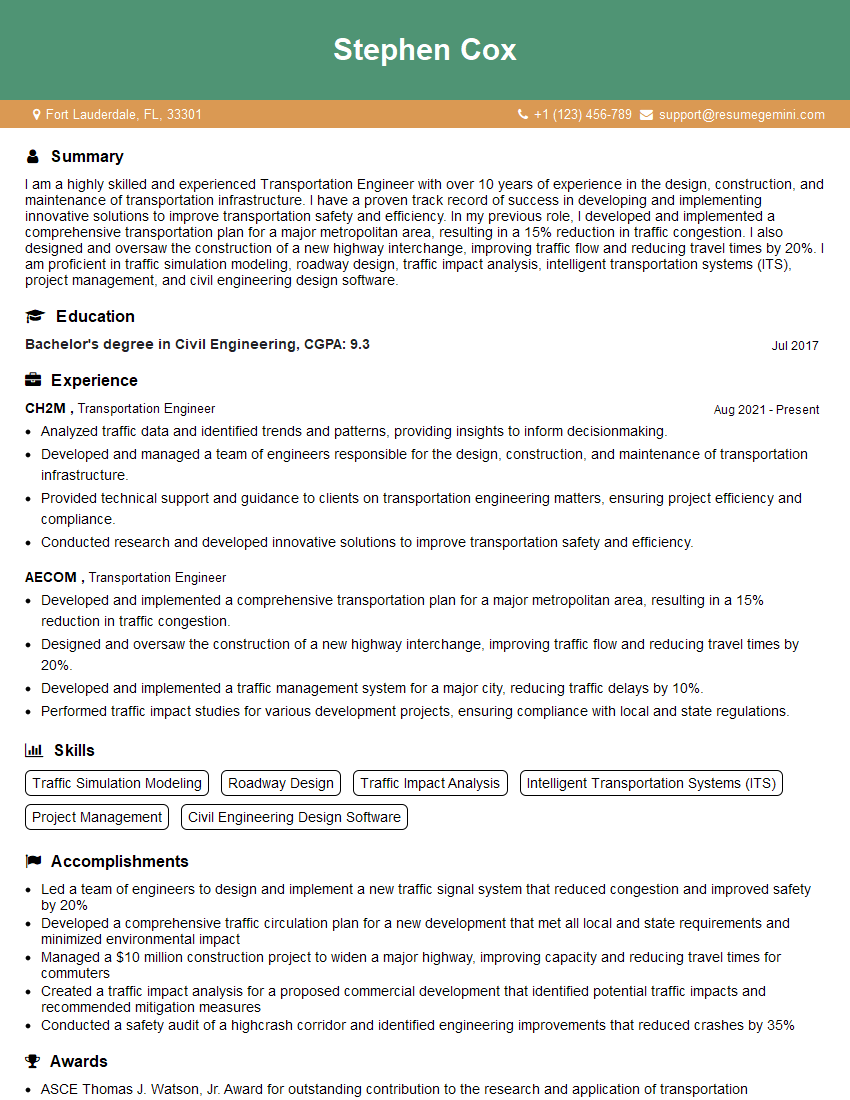
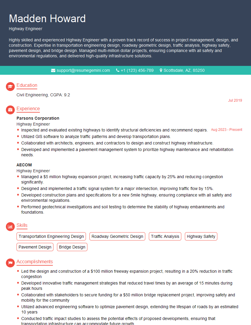
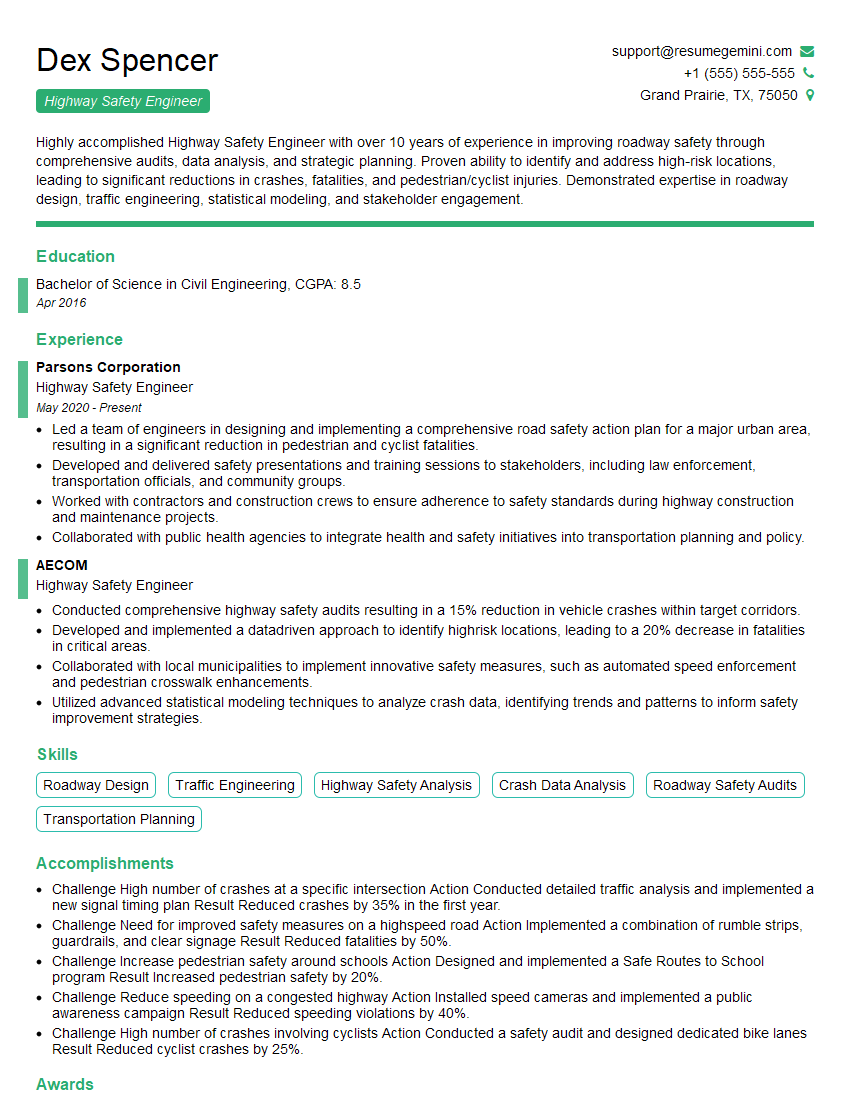
Mastering Interstate Highway Design opens doors to exciting career opportunities with significant growth potential. A strong understanding of these core principles is crucial for securing your dream role. To maximize your chances, create an ATS-friendly resume that highlights your skills and experience effectively. ResumeGemini is a trusted resource that can help you build a professional resume tailored to the specific demands of the Interstate Highway Design field. Examples of resumes tailored to this field are available to help you get started.
Explore more articles
Users Rating of Our Blogs
Share Your Experience
We value your feedback! Please rate our content and share your thoughts (optional).
What Readers Say About Our Blog
Hello,
We found issues with your domain’s email setup that may be sending your messages to spam or blocking them completely. InboxShield Mini shows you how to fix it in minutes — no tech skills required.
Scan your domain now for details: https://inboxshield-mini.com/
— Adam @ InboxShield Mini
Reply STOP to unsubscribe
Hi, are you owner of interviewgemini.com? What if I told you I could help you find extra time in your schedule, reconnect with leads you didn’t even realize you missed, and bring in more “I want to work with you” conversations, without increasing your ad spend or hiring a full-time employee?
All with a flexible, budget-friendly service that could easily pay for itself. Sounds good?
Would it be nice to jump on a quick 10-minute call so I can show you exactly how we make this work?
Best,
Hapei
Marketing Director
Hey, I know you’re the owner of interviewgemini.com. I’ll be quick.
Fundraising for your business is tough and time-consuming. We make it easier by guaranteeing two private investor meetings each month, for six months. No demos, no pitch events – just direct introductions to active investors matched to your startup.
If youR17;re raising, this could help you build real momentum. Want me to send more info?
Hi, I represent an SEO company that specialises in getting you AI citations and higher rankings on Google. I’d like to offer you a 100% free SEO audit for your website. Would you be interested?
Hi, I represent an SEO company that specialises in getting you AI citations and higher rankings on Google. I’d like to offer you a 100% free SEO audit for your website. Would you be interested?
good
